In Bend, a good day often starts with a pair of hiking shoes.
Surrounded by ponderosa forests, volcanic landscapes, waterfalls, alpine lakes and the Cascade Mountains, Bend puts an incredible variety of trails within easy reach. You can climb a volcano without leaving town, follow the Deschutes River through the forest or make a day of exploring farther into Central Oregon.
Whether you have an hour or an entire day, here are some of the best hiking trails in and around Bend, Oregon.
FOR A QUICK BEND HIKE
Pilot Butte
- Distance: Approximately 2 miles
- Difficulty: Easy to Moderate
- Best For: Panoramic views without leaving Bend
- You don't have to go far to find your first trail. Pilot Butte rises right in the middle of Bend, offering a relatively short climb with a big reward at the top.
- The roughly 500-foot ascent leads to sweeping views across Bend, the high desert and the Cascade Range. On a clear day, you can spot landmarks including the Three Sisters, Mount Jefferson, Black Butte and Mount Hood.
- It's an especially good choice when you want to fit a hike into a day that includes plenty of other Bend exploring.
FOR A WALK ALONG THE WATER
Deschutes River Trail
- Distance: Choose Your Own Adventure
- Difficulty: Easy to Moderate
- Best For: River views, pine forests and flexibility
- The Deschutes River Trail is less about reaching a summit and more about enjoying the journey.
- The Upper Deschutes River Trail follows the river south of Bend through pine forest and volcanic landscapes, with multiple access points that make it easy to choose a route that fits your day. Walk a short stretch along the water or turn it into a longer afternoon hike.
- It's a quintessential Bend experience and an easy one to work into a weekend itinerary.
FOR WATERFALL VIEWS
Tumalo Falls
- Distance: Varies by Route
- Difficulty: Easy to Challenging
- Best For: Waterfalls and forest scenery
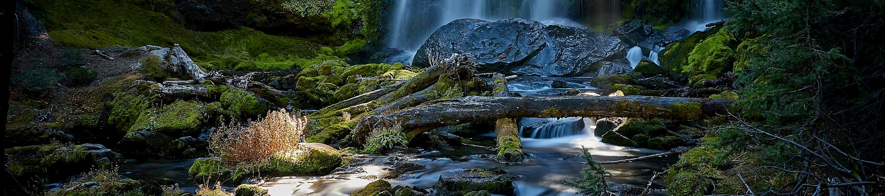
- At 97 feet tall, Tumalo Falls is one of Central Oregon's signature sights, and you can make the experience as easy or adventurous as you'd like.
- A short walk from the day-use area leads to the lower viewpoint, while a half-mile uphill trail takes you to the upper overlook. Have more time? Continue into the forest, where longer routes follow Tumalo Creek and pass additional waterfalls along the way.
- The falls are less than a 30-minute drive from Downtown Bend, making this an easy addition to a day of exploring. Seasonal road access can vary, so check conditions before heading out.
FOR A CLASSIC FOREST HIKE
Shevlin Park
- Difficulty: Easy to Moderate
- Best For: A quieter walk among the pines
- Sometimes you don't need a summit or a destination. You just want to walk.
- Shevlin Park offers miles of trails winding through old-growth ponderosa pine forest and along Tumalo Creek, all without venturing far from Bend. There are options for different abilities, including relatively flat paths and accessible trail features.
- It's a particularly good choice for a relaxed morning outdoors or when you want the scenery without committing most of your day to the trail.
FOR CASCADE MOUNTAIN VIEWS
Tumalo Mountain
- Distance: Approximately 4 Miles Round Trip
- Difficulty: Challenging
- Best For: Big views in a relatively short hike
- Don't let the mileage fool you. Tumalo Mountain packs plenty of climbing into its roughly four-mile out-and-back route.
- The payoff comes at the summit, where you'll find panoramic views of Broken Top, the Three Sisters and Mount Bachelor. Plan on roughly two-and-a-half to three hours and bring an extra layer, since summit conditions can be cooler and windier than they are back in Bend.
- This is a favorite for hikers who want something more challenging without committing to a full-day trek.
FOR AN ICONIC CENTRAL OREGON ADVENTURE
Misery Ridge at Smith Rock State Park
- Distance: Approximately 3.7 Miles
- Difficulty: Challenging
- Best For: Dramatic high-desert scenery
- The name is considerably less inviting than the view.
- Located at Smith Rock State Park, the Misery Ridge Loop climbs steep switchbacks above the Crooked River before reaching spectacular views of the Cascade Mountains, Central Oregon and Smith Rock's unmistakable Monkey Face formation.
- The loop is roughly 3.7 miles, with more than 1,500 feet of elevation gain, making it one of the more challenging hikes on this list.
- Take your time. The scenery gives you plenty of excuses to stop along the way.
FOR SOMETHING COMPLETELY DIFFERENT
Newberry National Volcanic Monument
- Difficulty: Varies
- Best For: Volcanic landscapes and making a day of it
- Central Oregon's volcanic history is part of what makes hiking here so interesting, and Newberry National Volcanic Monument offers an entirely different landscape to explore.
- Rather than choosing a single trail, give yourself time to discover the monument's lava flows, forests, lakes and volcanic terrain. The area offers a variety of hiking experiences, making it a worthwhile option when you want to venture beyond Bend and dedicate more of the day to exploring.
BEFORE YOU HIT THE TRAIL
Central Oregon's conditions can change considerably with the season, elevation and weather.
Before heading out, check current trail and road conditions, parking requirements and any applicable permits. Some hikes within the Central Cascades Wilderness require permits during the summer and early fall, and snow can affect higher-elevation trails well beyond Bend's warmer months.
Bring plenty of water, dress in layers and follow Leave No Trace principles while you're out exploring.
Then there's only one thing left to decide: where to hike first.
YOUR BEND BASECAMP
The best part about hiking in Bend? Coming back to somewhere comfortable when the boots come off.
Make The Newberry Hotel your home base for exploring Central Oregon, with downtown Bend, the Deschutes River and countless outdoor adventures within easy reach.
Start the morning with breakfast and locally roasted coffee at The Franklin, spend the day on the trail, then return to The Newberry to settle in for the evening.
Tomorrow, there's always another trail.